by Ron Becker, Class of 2019
When the bridges start going up, we know it is the start of the boating season. The Chicago Park District manages 10 harbors across 14 miles of Lake Michigan shoreline. These harbors can accommodate more than 6,000 boats, making the CPD the nation’s largest municipal harbor system.
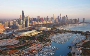
I wonder how many of the boaters are Loopers.
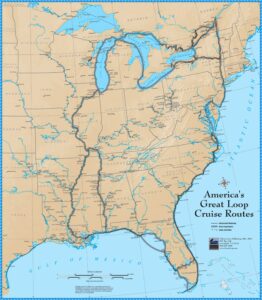
A Looper is a boater who attempts completing a circumnavigation of the eastern portion of North America by using natural rivers and manmade waterways, the intracoastal waterways, and the Great Lakes. Figure 1 shows a map of the common routes they take.
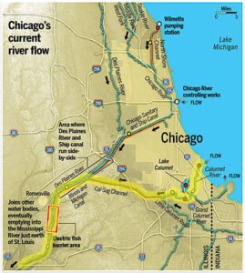
The best way to explain the Great Loop Cruise is to take a hypothetical trip. Since all Loopers must come through Chicago, we can start in Lake Michigan. As seen in Figure 2, we have two choices to enter the Chicago waterway system: either the locks on the main branch of the Chicago River or via Calumet Harbor. Then we cruise the Sanitary and Ship Canal, the Des Plaines River, the Illinois River, and the Mississippi River down to its confluence with the Ohio River.
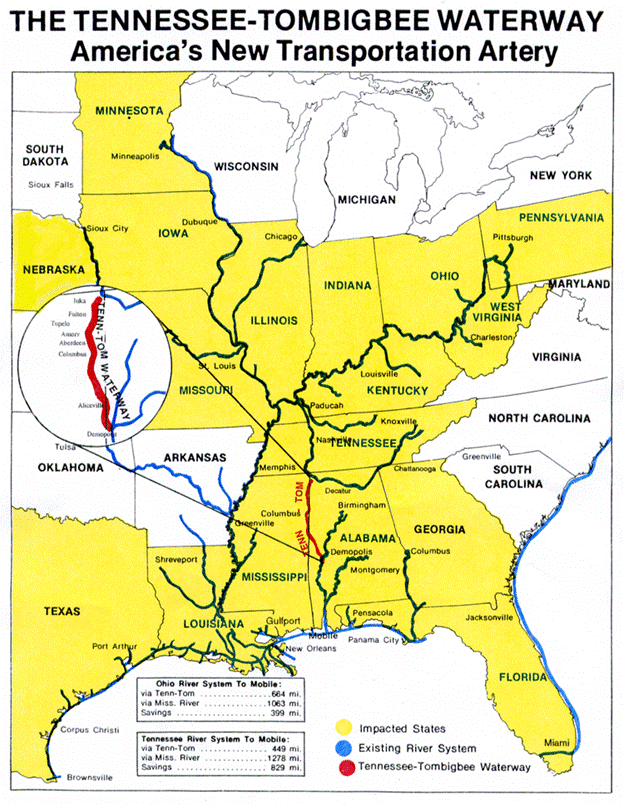
The traditional route would be to continue down the Mississippi River, but heavy commercial traffic and the paucity of cruising amenities lead most Loopers to head upstream on the Ohio River to the Tennessee River and the Tennessee-Tombigbee Waterway (the Tenn-Tom). The Tenn-Tom connects portions of the Tennessee River and the Tombigbee River with a 234 mile manmade canal. (See Figure 3) Constructed between 1972 and 1984 by the U.S. Corps of Engineers, it provides a shortcut for the central portion of the United States to ship products to the Gulf coast. The Tombigbee River empties into Mobile Bay.
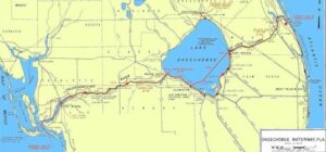
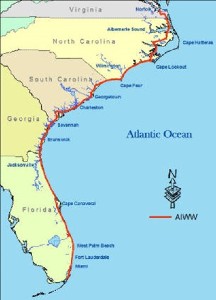
From Mobile, Alabama, Loopers follow the Gulf Intracoastal Waterway to its end at Carrabelle, Florida. From there they can continue to follow the Florida coastline or do an open-water run to a point farther down the coast. They would meet the beginning of the Atlantic Intracoastal Waterway at Key West to proceed up the east coast. However, many take a shortcut using the Lake Okeechobee Waterway. (Figure 4) The Lake Okeechobee Waterway uses the Caloosahatchee River, Lake Okeechobee, and the St. Lucie Canal to create a trans-Florida water route. It was built in 1937 to serve both as a transportation corridor and for flood control.
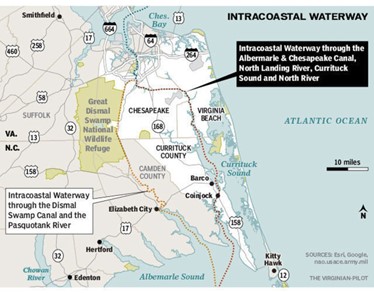
The Loopers take the Atlantic Intracoastal Waterway north to Portsmouth, Virginia, where the route splits into the Virginia Cut and the Great Dismal Swamp Canal before reuniting near Norfolk, Virginia. (Figures 5 & 6)
From Norfolk, Virginia, the Great Loop route heads north through Chesapeake Bay, the Chesapeake and Delaware Canal, Delaware River and Bay, and through the Cape May Canal into Cape May Harbor, New Jersey. (Figure 7) From Cape May, there is another choice: an open ocean voyage to New York Harbor or enter the sinuous New Jersey Intracoastal Waterway, which would still require a 44 mile open-ocean dash. (Figure 8)
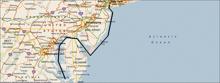
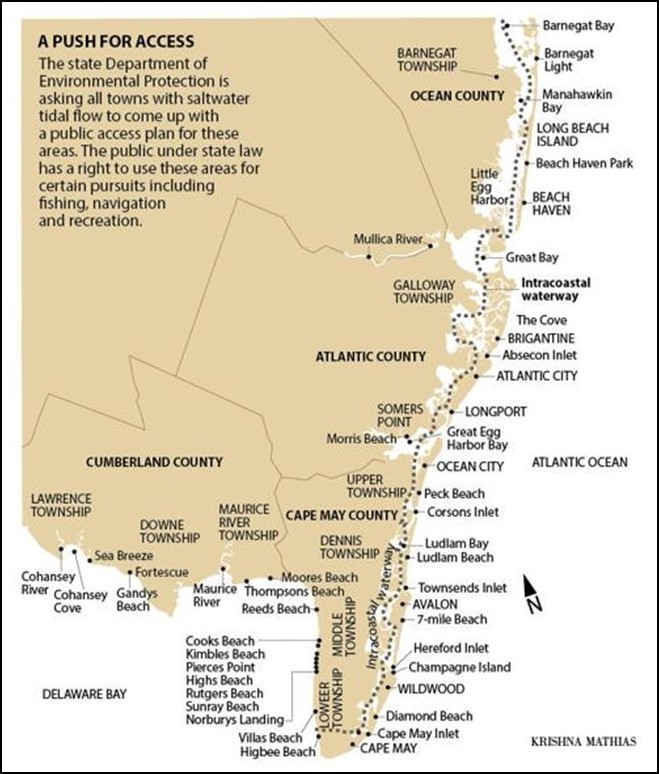
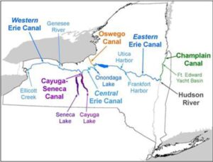
Fig. 8 New Jersey Intracoastal WaterwayFrom New York Harbor, a much longer and fraught route would be to continue cruising along the New England states and the Canadian Maritime Provinces and enter the St. Lawrence Seaway from the Gulf of St. Lawrence. However, most Loopers travel up the Hudson River and choose a route using some combination of New York State canals, Parks Canada canals, and the Great Lakes to return to our starting point on Lake Michigan. You have completed a Loop when you cross the wake from your departure. (Figures 9 & 10)
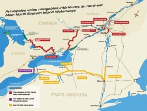
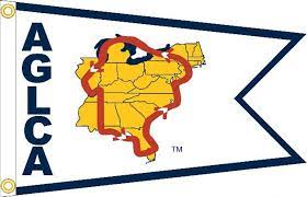
If along the lakefront or on the river you spot a boat flying the burgee of America’s Great Loop Cruisers’ Association, you are looking at a Looper. The white burgee indicates someone currently on their first loop; gold, a boater who has completed a loop; and platinum, one who has completed two or more loops.

So, is eastern North America an island?
____________________________________________________________________________________________________
CLICK HERE for more stories on The Bridge.

Ron this is so fun, thank you for sharing! My Folks did most of this starting in Holland, MI, Going through the North Channel and out via the Hudson. All the way down to Key West and back up the Tom Bigsbee to Kentucky Lake. They didn’t quite do the whole thing (about 400 miles short) so they technically are NOT loopers, but It was such an adventure for them! Great job on the article and thank you for sharing 🙂 Lisa
Ron, what an ambitious voyage you have taken us on! Thanks for researching and exposing me to so much more about U.S. waterways. Suzy Ruder
Thank you for such an informative article- i had no idea ! I would love to traverse some of these sections- I just need a boat. (!)
Thanks Ron, great article!!
Thanks for a fascinating article. Never heard of Loopers before. Seeing the title, I was thinking is that people who traverse the Loop in downtown Chicago?
Very interesting article! Thank you for sharing it!