
By Brian Kelly, Class of 2019
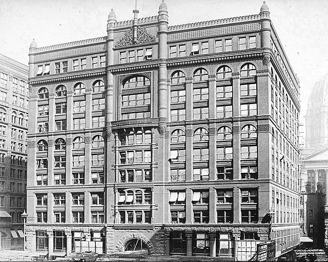
In 1888, the Rookery building opened for business on the southeast corner of LaSalle and Adams. It opened to universal acclaim as an innovative structure. Rookery was the largest speculative office building with more than 600 rental units. It was the most profitable. This was due in large part to the eyebrow-raising, financially beneficial land-lease from the lot owner, the City of Chicago.
But is Rookery on city land? Or does it reside within the traditional homelands of the many Indigenous nations who were the inhabitants when the first Europeans arrived?
The English colonies, located along the shore of the Atlantic Ocean, were restricted to the coastline due to the dense forest and Appalachian Mountains that lie to the west. The French explored interlocking waterways: the St. Lawrence River and the Great Lakes with portage to the Mississippi River. The concept of linking the Great Lakes to the Mississippi by means of a canal at Chicago was first suggested by Louis Joliet in 1673.
England and France approached relations with the Indigenous Nations differently. Initially, both pursued a “Middle Ground” in which they mutually benefitted from their relationship, and neither party could fully impose its will upon the other. The nature of the “Middle Ground” changed over time.
In 1775, Britain’s colonies rebelled and secured their independence in April, 1783. The Treaty of Paris was ratified on January 14, 1784 and established the United States of America. Its geographic boundary: all of the area east of the Mississippi River, north of Florida, and south of Canada. Britain did not include their Native allies in the Treaty negotiations. The U.S. Confederation Congress created the Northwest Territory, between the Appalachian Mountains and the Mississippi River, in July, 1787.
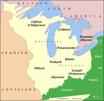
.
Britain retained possession of the northern shoreline of the St. Lawrence River and four Great Lakes: Ontario, Erie, Huron, and Superior. Britain inhibited U.S. western expansion by weaponizing tribes and conducting terrorist raids in the Northwest Territory. The Northwest Indian War was fought from 1784 – 1795 for control of the Northwest Territory.
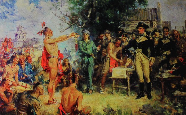
Treaty of Greenville, Greenville, Ohio; signed August 3, 1795, proclaimed December 22, 1795
.
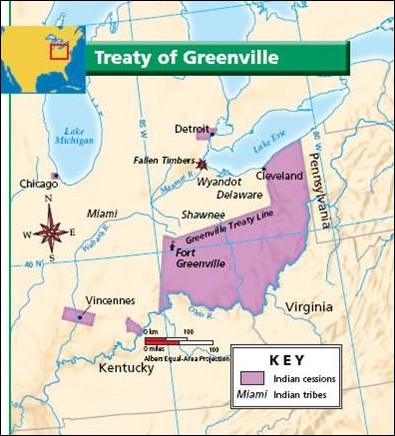
The U.S. reached agreement with the Northwest Indian Confederation and signed the Treaty of Greenville (Ohio) in August, 1795. The Treaty was negotiated between the United States and multiple tribes: Northwest Confederacy, Council of Three Fires, Wabash Confederacy, Illinois Confederacy (Peoria and Kaskaskia), Meskwaki (Sac, Fox), Ho-Chunk, Menominee, Kickapoo/Kiikaapoa, and the Mascouten Nation.
.
The Treaty established the Northwest Territory as exclusive U.S. land. Included among the lands relinquished to the U.S. were strategic locations on primary waterways securing the northern U.S. border with the British.
Two of these were fundamental to the creation of Chicago:
1) one piece of land six miles square at the mouth of Chicago River ceded by the Anishinaabeg, the Council of Three Fires: Odaawaa/Ottawa, Ojibwe/Chippewa, and Potawatomi/Bodewadmi.
2) one piece of land 12 miles square at the mouth of the Illinois River ceded by the Meskwaki: Sac/Sauk and Fox.
An agreement in principle was established:
.
Said Indian tribes will allow the people of the United States a free passage by land and by water from the mouth of the Chicago River to the portage between the Chicago and Illinois rivers and down the Illinois River to the Mississippi.
Britain and the United States returned to war in 1812. Native Peoples found themselves pulled into the conflict. At the end of the conflict, Great Britain agreed, within the 1814 Treaty of Ghent, to neither arm nor trade with American Indians in the United States and dropped the proposal of a pro-British Indian barrier state.
From 1795 to 1835, just 40 years, seven treaties were negotiated and enforced. Multiple treaties to ensure land rights were attained from not just one tribe but many tribes. There was redundancy, intentional confusion, and coverage of a range of conflicting claims. Each agreement was increasingly more onerous for the Native People as the U.S. objective migrated from national security to national expansion.
Eventually ownership of all forms of water transportation, lakes and rivers, were secured. The Northwest Territory retained limited tracts of Anishinaabeg land; however most were moved first to Iowa, Missouri, then Kansas, and finally into Oklahoma.
So, the answer to these two questions –
.
Is the Rookery on City Land? Does the Rookery reside within the traditional homelands of many Indigenous nations?
– is yes.
Author’s note: Stay tuned for the next story: the land sale to Phillip Peck, then to the City of Chicago for use as Water Tower and later a temporary City Hall, and then leased to the Central Safety Deposit Company which commissioned the construction of the Rookery building.
CLICK HERE for more stories on The Bridge.

I really appreciate the easy to understand narrative, the pictures, and now I understand much better. Thank you, Brian!
Thanks Ronnie Jo!
It is a complicated subject with tragic consequences.
peace